22 December 2009

MTB trails - TG Halli - Manchanbele

Last weekend, we took off again for a short ride to TG Halli reservoir - a round trip of under 65Km. Or so we thought. At the end of the day, we ended up discovering a great new MTB trail and returned with 97Km under our wheels...

As usual, we started off from IISc at about 05:45H. There were only five riders, Poovaiah on his new FOMAS Road King delux (a two week old road bike, but more on that later), Devendra with his Hawk, and three MTBs - Prakash, Sree (Hero Thunder) and me. We had all assembled at C mess parking - which has become a sort of ceremonial flag-off point - by 5.30. After some debate on the route to take, we decided to head out via NH4 and ring road, to Magadi Road, which would lead us to our destination - the TG Halli reservoir and dam. There was the option of taking pipeline road, and cutting a few km off, but none of us knew the road well enough to risk it in the pre-dawn darkness.

We proceeded at a gallop till Magadi road, all downhill. The first climb on Magadi road was pretty tough and knocked the wind out of our sails. After a few minutes of rest we set off again. About 5km down the road deteriorated into an almost-MTB terrain, slowing us to a crawl. Even the MTBs were having a tough time. But as we approached the city limits, the road became much better and we picked up the pace again. This section of the road, all the way till the T. G. Halli reservoir, is very scenic, with rolling hills, gentle slopes and big shady trees.

We overshot the entrance to the reservoir itself by about 4km. By then we had done about 35km non-stop, and we were desperately looking for some breakfast.A few km ahead is a small village where we downed a few plates of idlis, bananas and some tea.


Then came the big question of what was the easiest route to Manchanbele. From the locals we found that there were two options - go a few km back and ride almost straight to Manchanbele along a narrow off road trail, or ride straight on along the state highway, covering a big loop to Manchanbele. We chose the first.

The trail turned out to be superb. It started off as metalled road in bad repair. Soon afterward the road became a graveled path, and within the next few kilometers had become a trail rutted with tractor tracks. We discovered that the tractors and motorcycles belonging to the farmers along the trail were the only vehicles that came this way.


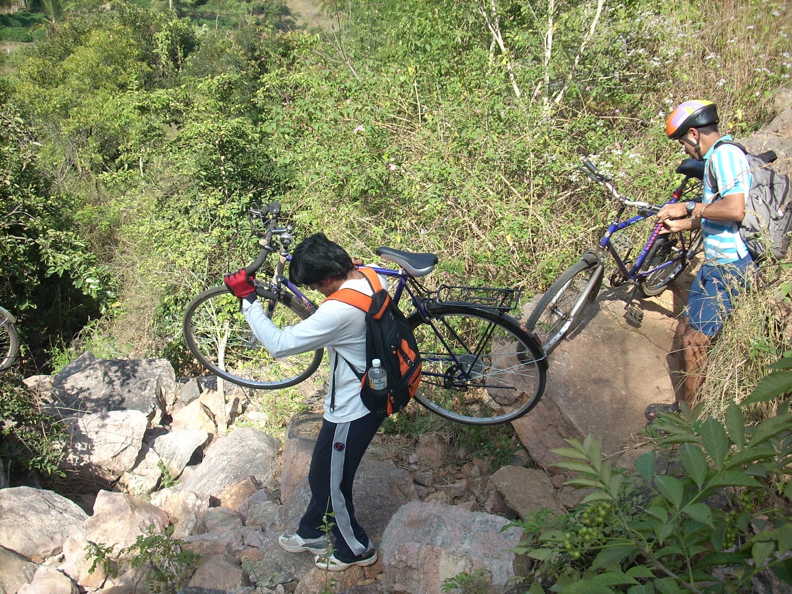
 About halfway to Manchanbele, the  trail became narrower - barely wide enough to walk - with wild plants brushing our calves.At one point we actually had to carry our cycles across a small gulch. After we crossed the trail became wider and eventually hit the banks of the Manchanbele reservoir.


On the return, we took the highway via Big-Banyan-Tree and the Byayalu station. The biggest problem on this route is, i believe, the lack of good places to have food.

31 October 2009

Aanekal and Pearl Valley Cycling Trip

The IBN (IISc Bikers Network) set off again on Saturday morning, this time in a different direction - to Pearl Valley water fall, near Anekal, southeast of Bangalore.

Route: see map here. From the Madivala junction, the traffic starts to become a bit of a pain. This is Hosur Road (NH7), where construction of the elevated high speed corridor from bangalore to Hosur is in the final stages. However, since the elevated road is not yet open to traffic, we found ourselves rubbing elbows with a motley bunch of early morning travellers. In addition, the road is 4 lanes wide in either direction - two main lanes and two service lanes. The service lanes are fenced off in most places. I observed that vehicles use all four lanes so there was no sense in taking the service road. In fact it is a better idea to ride in the main lanes because
1. The fence prevents people from popping up on the left.
2. There is about 2' of room between the road edge and the fence, which comes in handy at times.

The turnoff for Anekal is one of the first major intersections. This stretch is extremely bad for about 3-4km. Road bikes had to slow to a crawl. To make things worse vehicles of all shapes and sizes are going in all possible directions - so it is essential to keep ones wits. Beyond that one bad stretch, however, the road is smooths, winding among the rolling hills, with gentle slopes and VERY NASTY TRAFFIC. A large part of this (both nasty and otherwise) traffic is BMTC buses (routes 356, 360, 600, etc) which reach as far out as Anekal. Innumerable times the buses forced us off the road. This goes on till Anekal, which, by the way, is a good IVC* point. [IVC = Idli Vada Coffee]

The last stretch, from Anekal to the waterfall site itself, it the best. The road has no traffic whatsoever, barring the occasional tractor. This stretch of about 4km, leads up to the KSTDC restaurant. Steps lead down from the restaurant towards a small 'waterfall' below, which serves as a good resting spot.

On the whole, the lack of good highway IVC joints and bad traffic are serious minuses to an otherwise scenic route.

UPDATE: Added some photos...


28 July 2009

Savandurga and Manchanbele

Photos from an early tour of Savandurga and Manchanbele, with Mohammadi and Poovaiah.

Road sign listing distances to prominent tourist attractions on Mysore Road

Kengeri Bridge seen from the Sounth

The road from the turn off Mysore road till Big Banyan Tree

Chandrappa Circle


28 June 2009

Nandi Hills Road Race

Photos from the Nandi hills Road Race, organised by the Bangalore Bikers Club.

Race to the clouds - Nandi peak seen from the approach road
The sweep car
Nandi temple at the top
Starting the descent
Back down - just after the base


14 March 2009

Ramanangaram and Janapada Loka

Some photos from my first ever (longish) bicycle tour - to Ramanagaram, followed by some trekking, then lunch at Kamath Lokaruchi, rest at Janapada Loka and ride back to IISc.


Temple on top of Ramdevara Betta at Ramanagaram
A temple on the top of Ramdevara Betta

Rainfed Lake on Ramdevara Betta at Ramanagaram
A small rainfed lake in the rock

Rainfed Lake on Ramdevara Betta at Ramanagaram
The lake - it even had fish in it!

View from the nearly the top of Ramdevara betta at Ramanagaram
The view from the top

View from the nearly the top of Ramdevara betta at Ramanagaram

The rocky outcrops at Ramdevarabetta


Steel ralings and steps cut into the rock for climbers on Ramdevara betta
The climb is possible only because of steps cut into the rock and steel railings all along

Janapada Loka, on Mysore Road just beyond Ramanagaram
Janapada Loka